
Conservation researchers are launching an extensive wildlife tracking project along a heavily traveled corridor in the Mojave Desert to prepare for the construction of two dedicated wildlife overpasses. The initiative, led by the Wildlands Network, focuses on a critical section of State Route 62 located east of the Victor Valley, bridging the natural landscape between Yucca Valley and Palm Springs.
The primary goal of the field research is to evaluate how native animals navigate the terrain surrounding the highway and to gather essential baseline data prior to the installation of the crossings. By monitoring wildlife habits in the area, scientists hope to ensure that the future overpasses are strategically placed and tailored to the behavioral needs of local species.
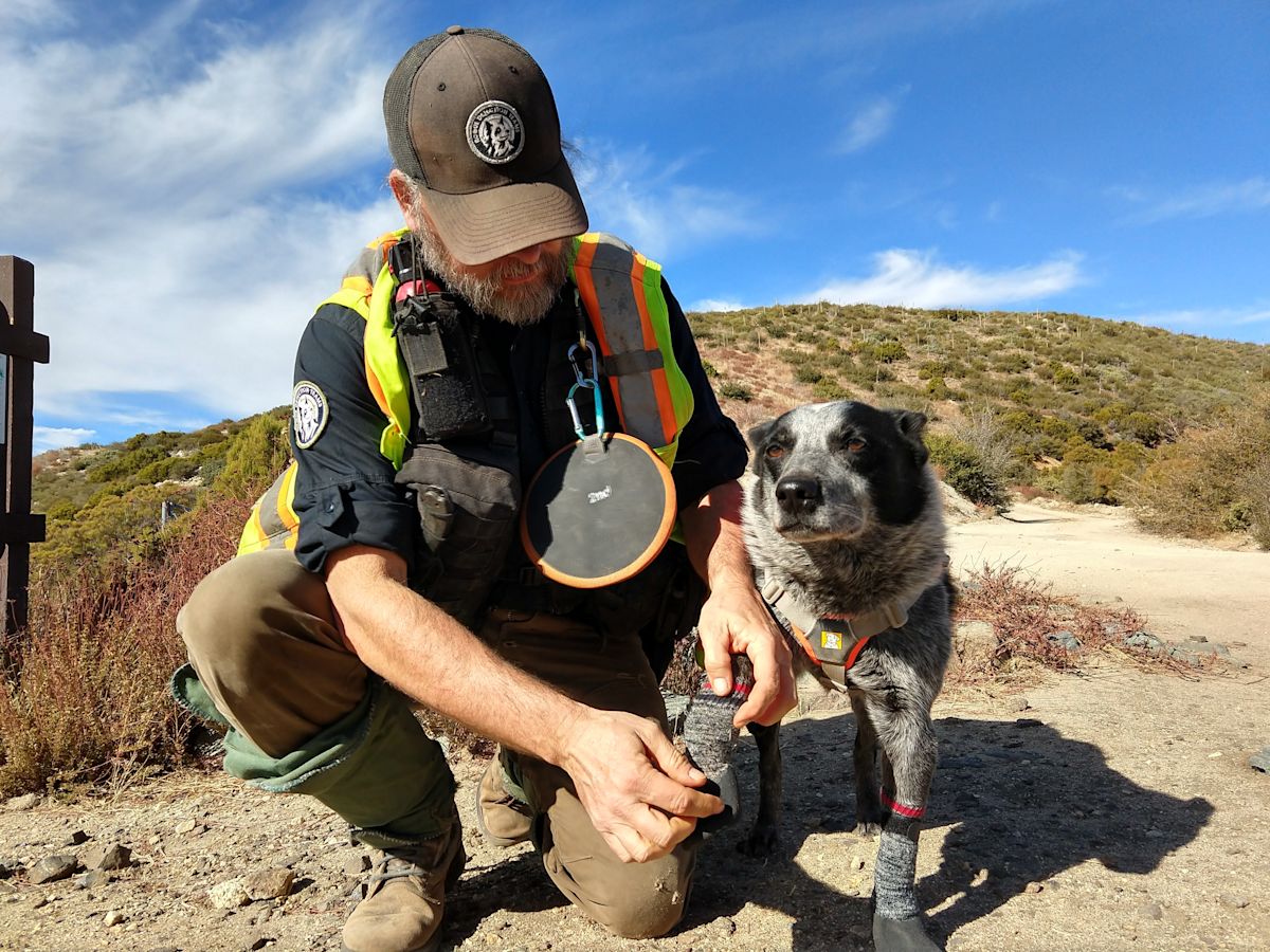
To conduct the research without disrupting the local fauna, field crews are utilizing non-invasive survey methods. Specialized teams consisting of professional field biologists and trained scent-detection rescue dogs are being deployed across the desert terrain. These detection dogs are specifically trained to identify the scent of scat left behind by elusive predators such as mountain lions and bobcats.
Field biologists working alongside the canines bring an in-depth understanding of animal tracking, environmental indicators, and behavioral patterns. Once the detection teams locate mountain lion or bobcat fecal droppings, the samples are carefully cataloged and preserved for laboratory processing.
A dedicated research team with years of specialized experience studying desert bighorn genetics, habitat utilization, and movement patterns throughout the Mojave Desert will oversee the survey work focused on bighorn sheep. This team will track and gather bighorn scat across key corridors bordering the highway.
All collected biological samples will be sent to specialized genetics laboratories. Technicians will extract DNA from the scat to identify specific individual animals. This genetic analysis provides researchers with critical information regarding how frequently animals attempt to cross the highway corridor, while also revealing the current extent of genetic exchange between separated animal populations.
The field operations have been organized into distinct operational windows. The specialized bighorn sheep assessments are scheduled to take place on September 25, operating between 9 a.m. and noon. The dog-assisted search operations, conducted in collaboration with Rogue Detection Teams, will follow shortly after on October 6, also running from 9 a.m. to noon.
The urgency of the research stems from a substantial rise in vehicular traffic along State Route 62 over the preceding ten years. Regional land trust representatives note that this surge in traffic volume has been fueled by steady residential growth within the Morongo Basin, combined with a dramatic threefold rise in tourist visitation to nearby Joshua Tree National Park.
As traffic volumes have multiplied, State Route 62 has become a perilous obstacle for local wildlife. Multiple animal fatalities have been recorded along this stretch in a single year, claiming the lives of mule deer, black bears, mountain lions, and desert bighorn sheep. The high frequency of collisions has drawn mounting concern from wildlife agencies, researchers, and local conservationists.
Beyond immediate animal mortalities, highway infrastructure creates severe ecological fragmentation. When wide roads sever natural habitats, animal groups become isolated from one another. Conservation scientists emphasize that maintaining landscape connectivity is vital for desert species, as continuous movement allows populations to find resources, maintain broad gene pools, prevent inbreeding, and build resistance against disease outbreaks.
The data gathered during the upcoming autumn surveys will establish an empirical baseline documenting wildlife interactions with the roadway before construction begins. Highway planners and engineers will use these findings to optimize crossing designs. Following construction, researchers will continue to monitor the sites to evaluate how effectively the new infrastructure restores connectivity.
Engineers and conservation planners have slated the two wildlife overpasses for high-risk points along State Route 62, specifically at the Morongo and Yucca grades. These locations were selected because historical records indicate they are hotspots for dangerous animal-vehicle collisions and severe wildlife mortality.
The proposed overpasses will be built with an earthen foundation and layered with living native vegetation matching the adjacent desert ecosystem, encouraging wildlife to step onto the structures naturally. In addition, the crossings will incorporate directional wildlife fencing along the road edges to funnel animals toward the safe passages, alongside specialized engineering measures designed to shield crossing wildlife from traffic noise and vehicle headlights.
Project leaders stress that the planned overpasses are designed to deliver mutual benefits for both desert ecology and regional motorists. By safely routing large mammals over the highway rather than across active traffic lanes, the structures are expected to significantly reduce vehicular collisions, enhancing driver safety while protecting vulnerable wildlife populations.
The comprehensive planning process and long-term wildlife monitoring efforts have been made possible through major grant awards. Funding for the partnership has been secured from both the California Wildlife Conservation Board and the Coachella Valley Mountains Conservancy, ensuring that regional planners have the resources required to advance the wildlife crossing initiative.





(0)